Give Your Students the Power to Connect to Real Satellites 22,000 Miles Above Earth!
This is not a simulation. This is real space data.
-
Build.
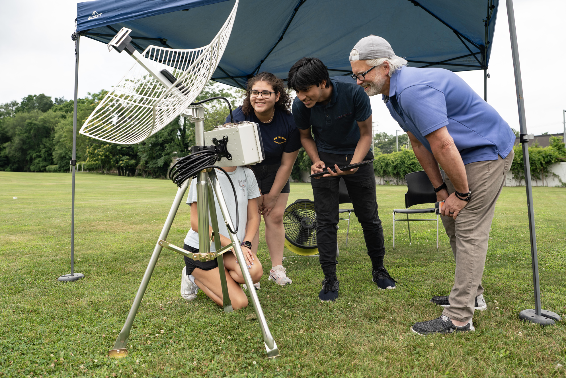
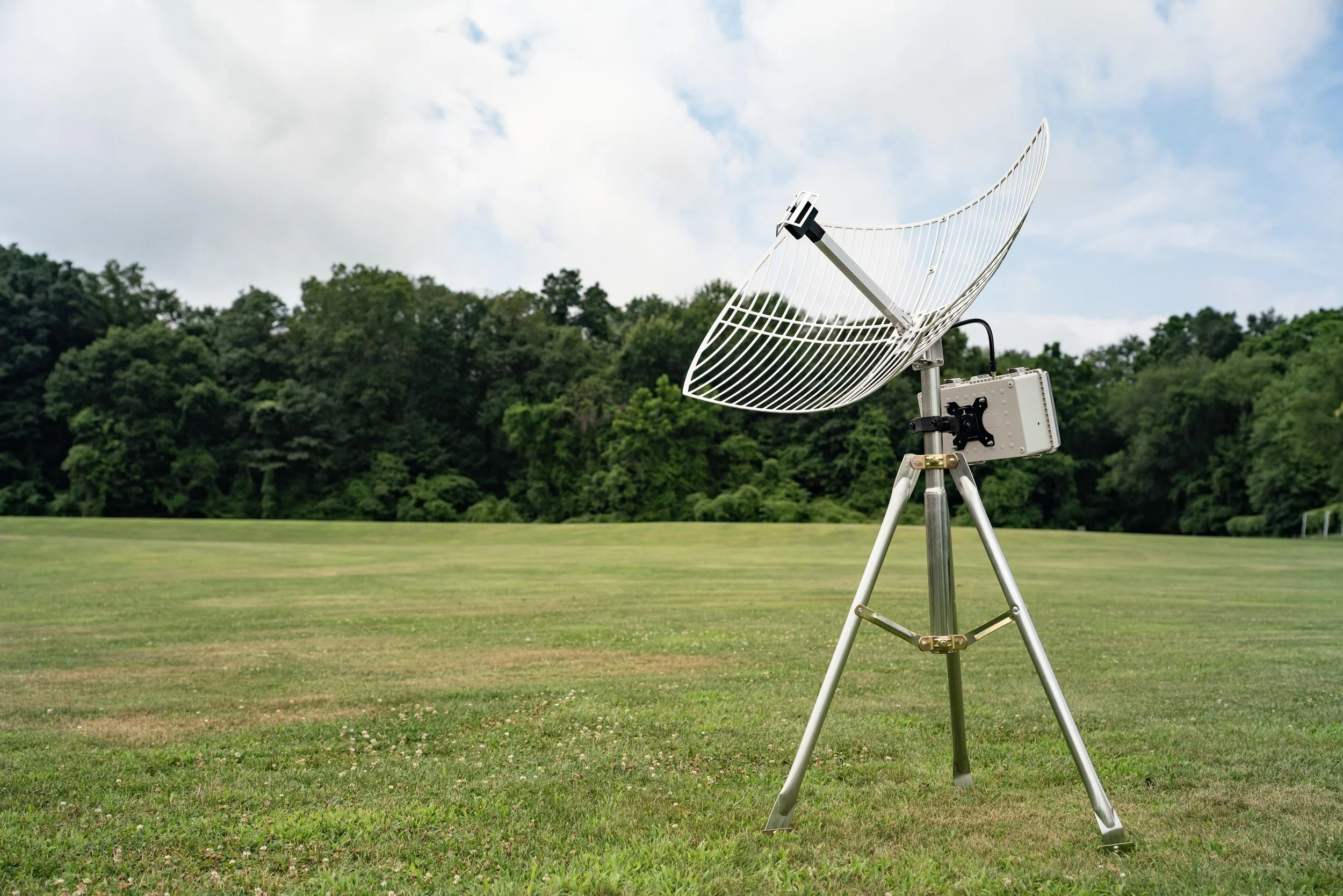
With our Satellite Kit, students take on the role of scientists and engineers at their very own Mission Control. They'll assemble the hardware, configure software, align the antenna, and begin capturing and decoding live satellite imagery from NOAA's GOES satellites.
-

Capture.
Students aren’t just watching satellite images appear—they’re capturing them, decoding them, and exploring their meaning like real meteorologists and Earth scientists. Understand how satellites are used in weather forecasting, emergency response, and environmental monitoring
-

analyze.
Once students begin receiving satellite imagery from GOES it’s time to turn that data into insight. Learn how to organize, store, and analyze raw satellite images to uncover real environmental patterns—just like NASA scientists and NOAA meteorologists.
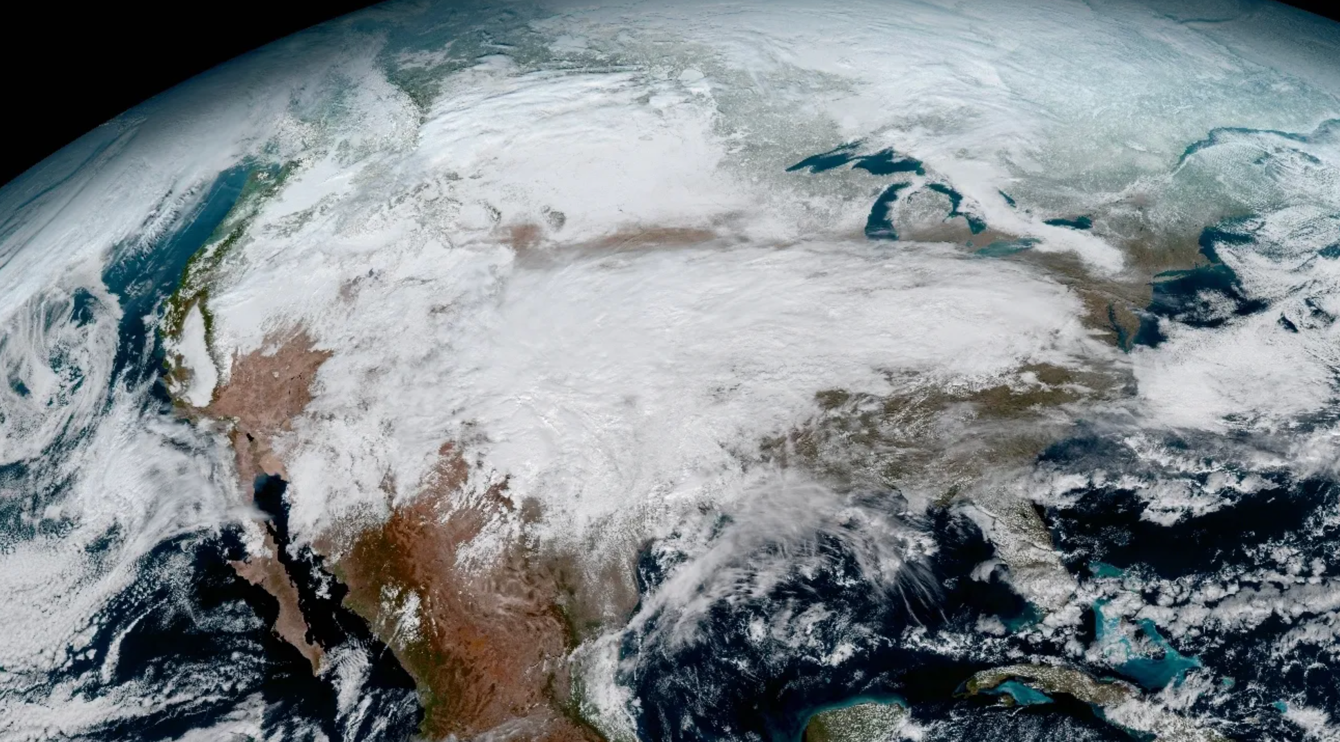
Live Satellite Feed 🔴
Straight from Space, No Internet Needed

This is a real-time LIVE satellite image captured using a base station built by students using Space Kitz.
It updates every few minutes—no Wi-Fi, no cell service, just direct data from GOES satellites in geostationary orbit.
Imagine your students decoding images like this right from the school yard.
Create a Classroom of Pride and Inspiration
Imagine the pride you'll feel when your students are inspired by their classroom—where space science isn’t just taught, it’s lived. The Signal Hunters Kit fosters a sense of growth and achievement, giving your students the chance to connect to real satellites, track weather systems, and engage in hands-on science. You’ll be creating a space where students are excited to learn and proud to share their discoveries.
Efficiency That Frees You Up to Teach
You don’t need a lab or tech department. Just plug it in, point it at the sky, and you’re capturing real data from a real satellite. The Signal Hunters Kit makes it easy to get started—no hassle, no complicated setup. With everything you need right in the box, you’ll be able to integrate satellite learning into your STEM curriculum without spending hours on preparation. Focus on teaching, not on complicated tools, and make your classroom run smoother with ease.
Budget-Friendly Innovation for Your Classroom
Tight budgets shouldn’t limit your ability to provide quality education. The Signal Hunters Kit is a cost-effective way to bring cutting-edge satellite technology into your classroom without breaking the bank. You’ll get a powerful educational tool that offers students real-time learning without hidden costs, making it the perfect investment for your classroom.
curriculum
We built the Signal Hunters curriculum to go beyond STEM buzzwords. Students don’t just learn about satellites—they connect with them in real time. From constructing antennas to analyzing live infrared imagery, this is hands-on, NGSS-aligned learning that inspires curiosity and builds real-world skills.
An immersive 10-week experience
Students start by exploring how satellites orbit, gather data, and communicate with Earth
🛰️ Weeks 1–3:
Satellites & Orbits
Learn how satellites transmit information across the electromagnetic spectrum.
Discover Newton’s and Kepler’s Laws in action to explain orbital motion, speed, and gravity
Case studies like GOES, NOAA, Meteor-M2, and Landsat
Hands-on projects and presentations bring theory into real-world context
📡 Weeks 4–6:
Radio Science & Signal Discovery
Construct the satellite dish & ground station.
Capture your first real satellite image directly from orbit
Learn about binary, hexadecimal, and ASCII encoding
Explore how data is transmitted, received, and corrected for errors
Decode live weather satellite signals
🌦️ Weeks 7-8:
Weather, Data & Satellite Imagery
Decode and visualize real data
Capture and explore images from NOAA satellites
Analyze temperature, wind, water vapor, and ozone
Create RGB composites and map projections
Use real-time geospatial data to study Earth systems
🚀 Week 9-10:
Capstone: Weather Tracking Investigation
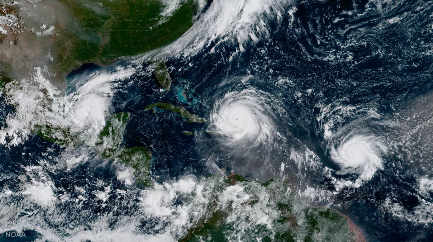
Analyze global climate models (GCMs) and compare European vs. American storm predictions
Track hurricanes, storms, and environmental events with real data
Design a satellite mission with defined goals, orbits, data types, and sensors
Build a final research project that simulates data transmission and presents results
all aligned to NGSS and designed to excite curious minds.
Get Started Today.
Order Your Signal Hunters Kit Today and take the first step toward transforming your classroom into a hub of inspiration and exploration.
** WE ACCEPT PURCHASE ORDERS **
-
How satellites use these signals for weather forecasting, navigation, and communication.
-
Capture NOAA weather imagery and Automatic Picture Transmission (APT) from passing spacecraft.
-
Like frequency, wavelength, signal-to-noise ratio, and modulation—all taught through engaging, real-world applications.
-
Unlocking the stories hidden in the signals.

Featured Blogs


Connect with Us
Whether you’re an educator ready to bring space science to your classroom or just exploring how SpaceKitz can ignite curiosity in your students — we’d love to hear from you.
** WE ACCEPT PURCHASE ORDERS **